Home » Flood Maps » About Flood Maps in BC

About Flood Maps in BC

Find Flood Maps in BC

To find flood maps relevant to the Lower Mainland, see:

What’s in a Name? How Different Flood Maps Show Different Things.

Floodplain Map Identifies the flood extent ─ the areas that would be flooded by a given flood (e.g., 200-year/0.5% AEP event) ─ and may show flood elevations and/or depths. These areas are designated as flood hazard areas, usually for planning or regulatory purposes. In these cases, some flood maps show the areas where flood construction levels apply.
Flood Hazard Map Provides information relevant to a given flood or modelled flood scenario, such as flood extent, water depths and/or flow velocity. It shows the intensity and magnitude of the flood.
Flood Vulnerability Map

Identifies assets that could be flooded under a given flood. Flood extent or depth information is shown together with assets that are exposed to the flood, such as buildings, emergency facilities, critical infrastructure and schools.
Flood Risk Map

Reflects the potential consequences from a given flood event or series of floods. It can incorporate data about population, infrastructure, buildings, and environmental, cultural and other assets that could be affected. Risk is usually expressed in terms of financial impacts. For example, it can show the likely financial losses for a 0.2% AEP flood, or it can show the average loss per year for a range of flood probabilities. When non-monetized impacts are involved, a flood risk map can reflect a relative score to enable comparison of consequences in different areas.
Emergency Planning Map Shows information that could be relevant during a flood emergency. Depending on the scale of the map, this could include dikes, critical infrastructure, disaster response routes, evacuation zones, emergency shelters and other information relevant to inform emergency planning and response.

How Flood Maps are Developed and Used

  • Land use planning and regulation: Knowledge about the location of flood-prone areas, the probabilities of different flood events, and the associated flood elevations is essential for land use and development decisions that help protect people and property from floods.
  • Prioritizing areas for flood risk reduction measures: Identifying the areas at higher risk (more likely to be flooded and/or have higher potential consequences) can help decision-makers in setting priorities.
  • Emergency response/planning: Information shown in emergency maps is useful for authorities, emergency service providers and the public, both for advance planning and in the event of a flood.
  • Education: Visual tools, such as maps, are valuable for educating decision makers and the public, and for increasing awareness of flood threats.
  • Buying and building on a property: Knowing the potential flood extent and depth in a given area can help current and potential property owners understand their risk and locate buildings out of harm’s way or opportunities to design in ways that minimize damage.
  • Insurance: Knowing which areas are prone to flooding can help insurance providers more accurately develop insurance options and help property owners assess those options.
  • Tip: When reading a flood map, find out the purpose for which the map was intended. It likely shows a single flood scenario, possibly for the purpose of planning land use or infrastructure. Many flood maps are high level and not intended to be relied on to determine whether an individual property will flood.
Province of British Columbia

In British Columbia, a provincial flood mapping program began in 1974, aimed at identifying flood hazard areas. Under the Canada/British Columbia Agreement Respecting Floodplain Mapping in 1987, the Province of BC continued developing flood maps until the early 2000s. At the time, 70 BC communities were mapped.

Maps were developed for the “design flood”—that is, the size of flood used for the design of flood infrastructure. In BC, the design flood is the estimated 0.5% AEP (“200-year flood”) for most communities and is the estimated 1894 flood of written record for the lower Fraser River (which is currently close to .2% AEP or “500-year flood”). Fraser River and Coastal floods are expected to become more frequent and
more severe in the coming decades under climate change. Standards for the design of dikes and other flood infrastructure need to be re-evaluated to account for projected changes in the flood hazard.

Provincial maps are now dated and do not cover all flood hazard areas across BC. Still, in many cases, they may still provide the best available information at a community level.

Local Governments

Responsibility for flood regulation and associated flood mapping shifted to BC local governments in 2004. In 2015, the federal government established the National Disaster Mitigation Program, a five-year, $200-million federal-provincial cost-shared program to support local governments and other organizations to develop and modernize flood maps (along with other types of flood risk assessment, planning and mitigation projects). As a result, some community flood maps have now been updated.

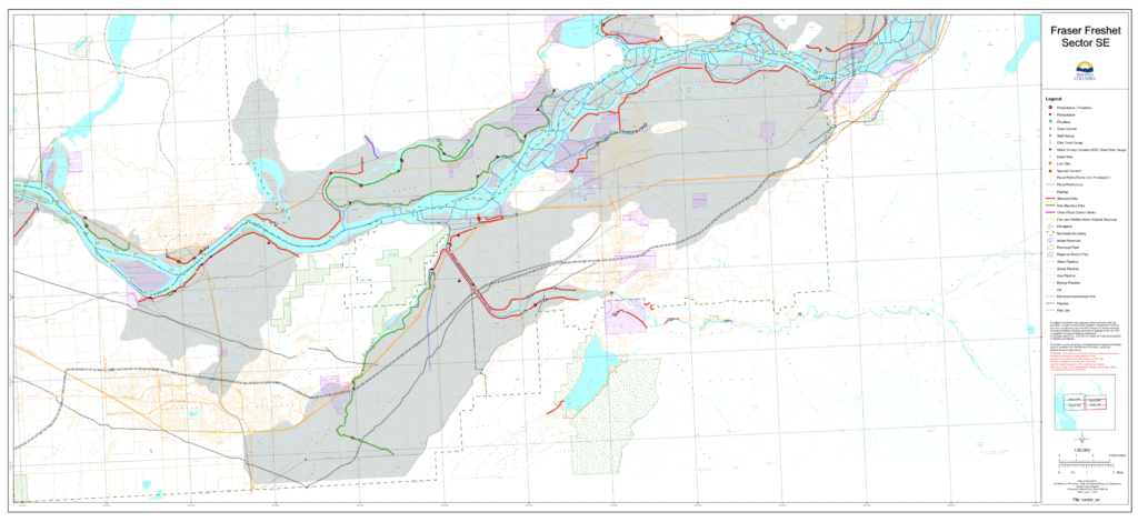
Why it Matters to Update Flood Maps

Communities change over time – and so does the nature of flood hazards. In the Lower Mainland, for example, coastal and Fraser River flood hazards are expected to increase in the coming decades and there continues to be new development in the floodplain.

Though a complex and expensive process, updated flood mapping is critical for flood management. Ideally, maps should be updated regularly as the landscape changes and as new information or flood modelling technologies become available.

The BC Real Estate Association and other organizations have advocated for provincial government investment in a flood mapping program.